Know Your Risk
 If you don’t know or understand how your property could be impacted by flooding, you have little reason to be concerned. The information on this page will help you identify and understand your risk.
Why is Batavia at risk of flooding?
One of the City’s main flooding risks is the Tonawanda Creek - a 101-mile-long tributary to the Niagara River. The creek drains approximately 631.9 square miles, making its watershed one of the largest in western New York.
The Tonawanda Creek runs through Batavia, and rain and snowmelt have caused flooding on several occasions. In December 2014 the creek crested to over 11 feet. A crest of 10 feet is considered flood conditions - a state the Tonawanda Creek has reached 24 times in the nearly 65 years that the National Weather Service has been measuring creek levels. To better understand the powerful force of the Tonawanda during flooding, click here to watch a video of the creek from December 2014. Video provided by Mark Gutman from from The Daily News:.
Because of the Tonawanda Creek and its history of flooding, a significant portion of Batavia is in the Special Flood Hazard Area (SFHA). Refer to links below to fully understand the large amount of geographical space our City has in its SFHA. Note the areas in red which are in the SFHA (the yellow lines indicate the City boundaries).
Another flooding risk that our City shares with many in the northern United States is those risks associated with Winter and Early Spring Flooding:
Ice Jams
Long cold spells can cause the surface of rivers to freeze, leading to ice jams. When a rise in the water level or a thaw breaks the ice into large chunks, these chunks can become jammed at man-made and natural obstructions, resulting in severe flooding.
Snowmelt
A mid-winter thaw can produce large amounts of runoff in a short period of time. Because the ground is hard and frozen, water cannot be reabsorbed. The water then runs off the surface and flows into lakes, streams, and rivers, causing excess water to spill over their banks.
Spring Thaw
During the spring, frozen land prevents melting snow or rainfall from seeping into the ground. Each cubic foot of compacted snow contains gallons of water and once the snow melts, it can result in the overflow of streams, rivers and lakes. Add spring storms to that and the result is often serious, spring flooding.
It is important to note that should your property flood as a result of any of these situations, your homeowners policy will not protect your home or valuables.
So, how do I know if my home is in danger of flooding? Click here to see the City of Batavia’s Flood Insurance Rate Map (FIRM) to determine if your property is in a flood hazard area, but remember, all properties are in a floodplain, some are just at less likely to flood than others. You may want to read the explanations below on how to use a FIRM and the explanation of the lettered flood zones before accessing the maps
What is a Flood Insurance Rate Map (FIRM) and how do I use it?
A FIRM is a map created by the National Flood Insurance Program (NFIP) for floodplain management and insurance purposes.
A FIRM will generally show a community's base flood elevations, flood zones, and floodplain boundaries. As a property owner/renter, you can use this map to get a reliable indication of what flood zone you're in. However, maps are constantly being updated due to changes in geography, construction and mitigation activities, and meteorological events. Therefore, for a truly accurate determination, contact your insurance agent or company, or the Inspection Department at City Hall at 585-345-6345. Our Certified Floodplain Manager can help you determine if you are in a flood zone and your base flood elevation as well as make flood mitigation suggestions regarding your property.
How do I know what the letters for each of the flood zones means on the map? For an explanation of all the lettered zones, visit this link:
https://www.fema.gov/flood-zones
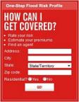
Another option to determine your flood risk is by using the One Step Flood Risk Profile just by inputting your address by clicking here: